| Mount Ruapehu |
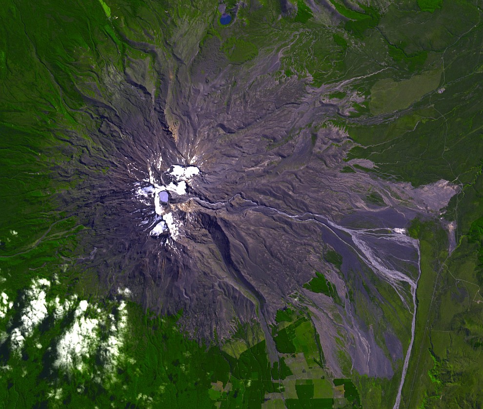 Ruapehu Lahar-Kanäle durch eine Schlammlawine nach dem Bersten und Auslaufen des Kratersees am 18.03.2007. Bild aus: http://de.wikipedia.org/wiki/Ruapehu (3.2.2015): NASA image created by Jesse Allen, using data provided courtesy of NASA/GSFC/MITI/ERSDAC/JAROS, and the U.S./Japan ASTER Science Team. - http://earthobservatory.nasa.gov/Newsroom/NewImages/images.php3?img_id=17596, cropped to show more detail. On March 18, 2007, a lahar burst out of Mount Ruapehu’s crater lake and flowed down the side of New Zealand's highest volcano. Seven days later, on March 25, 2007, the Advanced Spaceborne Thermal Emission and Reflection Radiometer (ASTER) on NASA’s Terra satellite captured this image of Mount Ruapehu and its new lahar. |